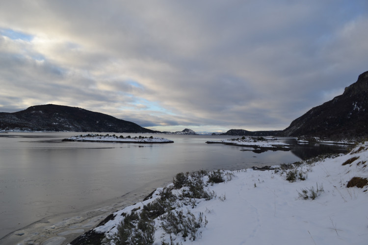
Located only a few kilometers from Ushuaia, the Tierra del Fuego National Park is a natural reserve of 63.000 hectares of sub-Antarctic landscape, with deep valleys, dense forests, peat bogs, a coastline, and a magnificent lake located between two mountain ranges. Discover the unforgettable experience of traveling through the unique nature of the End of the World.
When
January
February
March
April
May
June
July
August
September
October
November
December


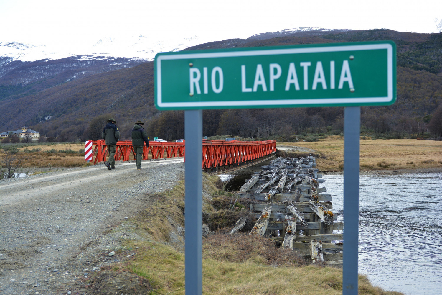


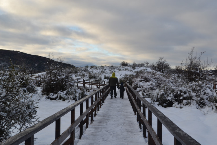
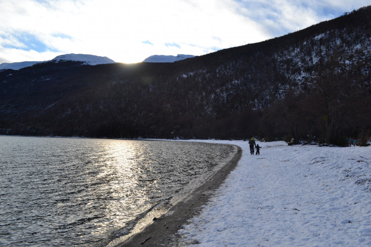

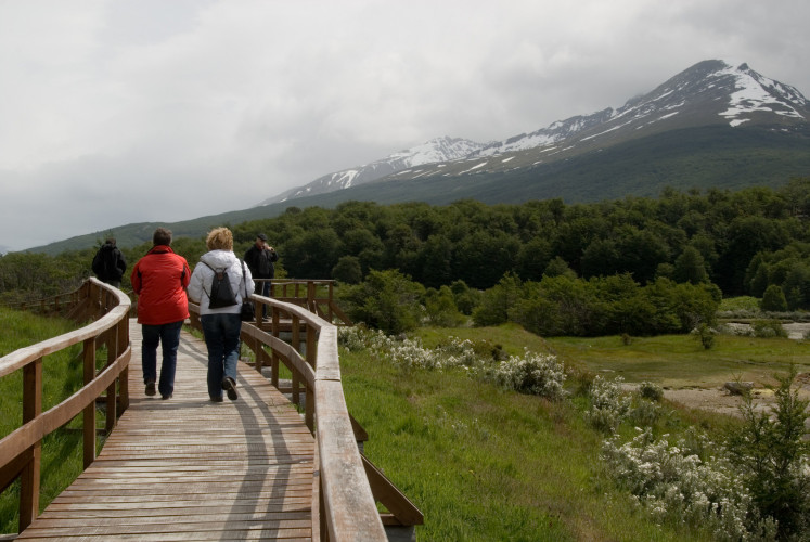

Tierra del Fuego National Park is located 12 kilometers west of Ushuaia, along National Route 3. Founded in 1960, it is the only national park in Argentina located between the mountains and the sea, since one of its ends borders the southwest coast of the Beagle Channel.
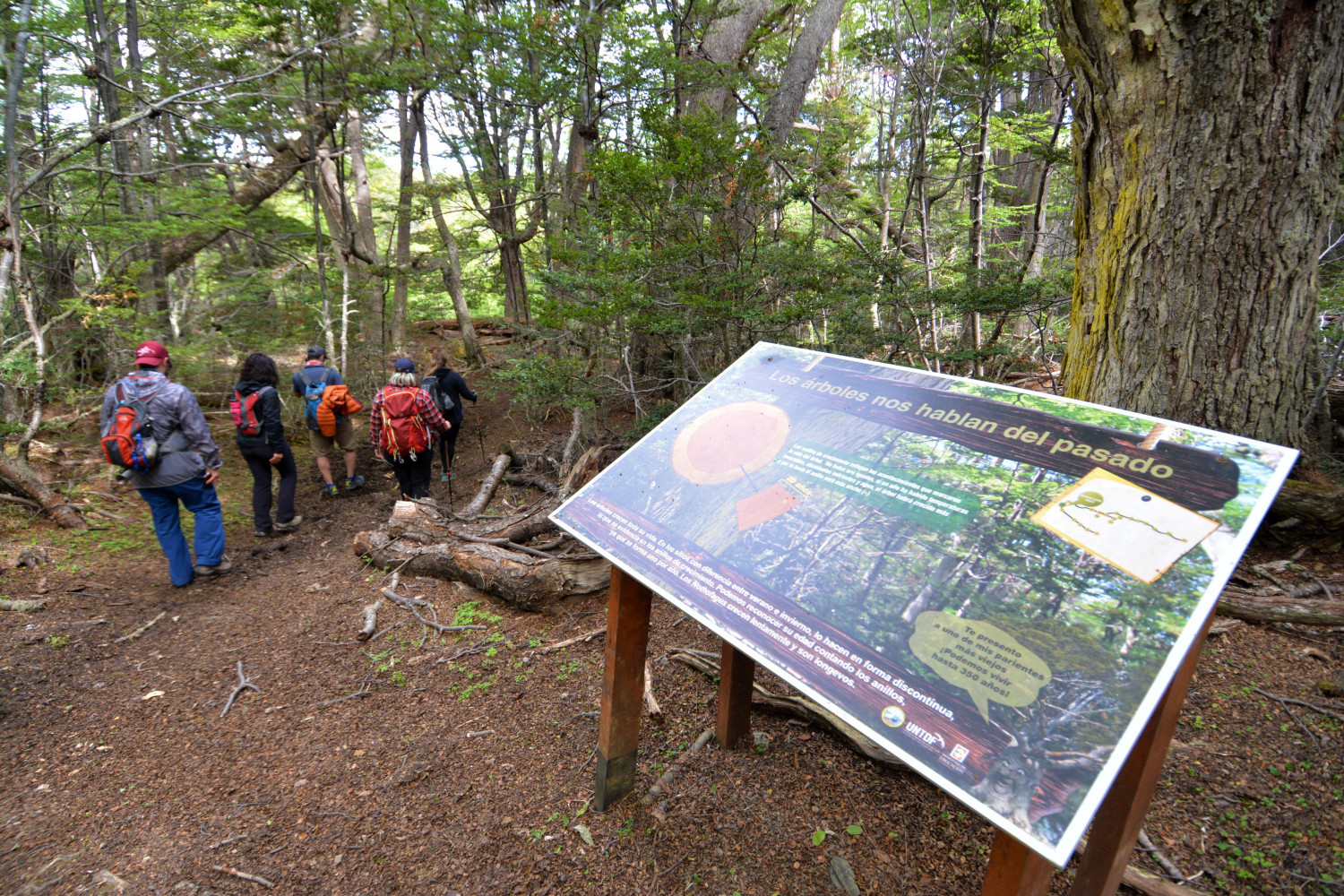
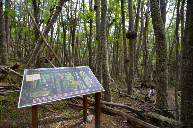
This southern reserve is home to native species such as the red fox and birds such as the caranca, the cauquén marino, the black-browed albatross, the southern steamer duck, the giant woodpecker and the Patagonian thrush , among others. The dense forests are made up of lengas, cherry trees, cinnamon trees and ñires. During autumn, the foliage of these trees creates an unforgettable postcard of red, gold and green colors.
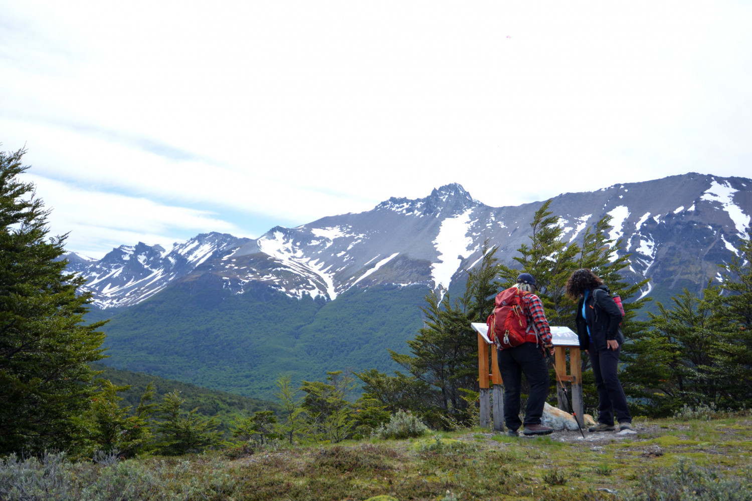
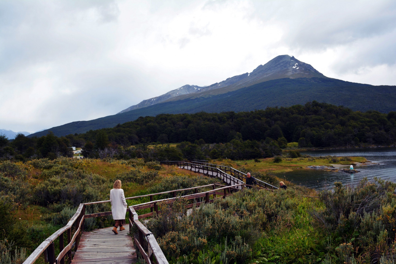
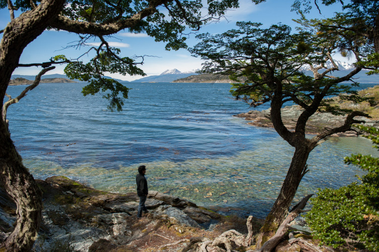
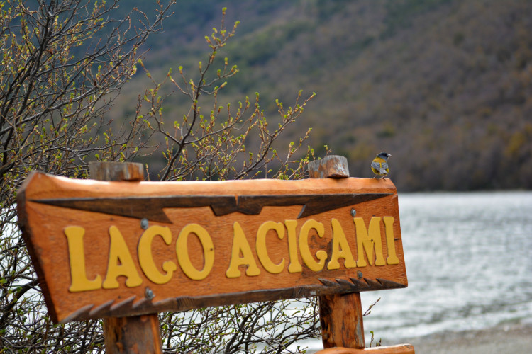
Its peculiar geography, which combines the maritime environment with the Andean mountain range, displays a captivating scenery. The serene beauty of Lake Acigami/Roca, called Acigami by the natives of the island, invites you to sit on its shore and enjoy the sound of the waves. Next to the lake, there is a camping area, and on the right bank, there is a path that leads to the Milestone 24 , which marks the territorial boundary with Chile. Another scenic spot is Lapataia Bay , where you will find the sign that marks the end of National Route 3.
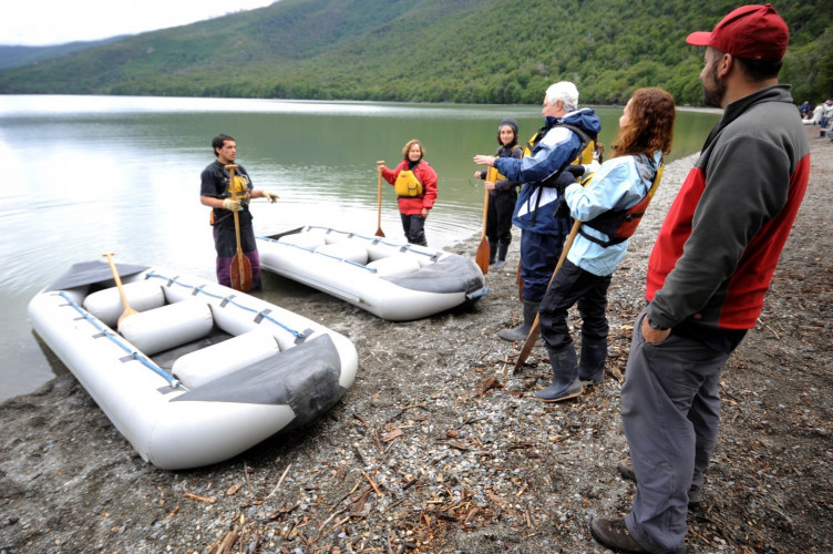
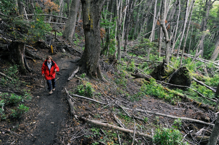
The activities allowed in this reserve are hiking, guided canoeing and fishing. For trekking lovers, the park is an ideal option, since it has a network of signposted trails of about 40 kilometers that vary in length and degree of difficulty. Below, you can check the listing of trails open to the public.
Low Difficulty Hikes
Paseo de la Isla : this trail runs along the shores of the Lapataia and Ovando rivers, from where you can see the Cormorant Archipelago. Approximate length: 800 meters.
Mirador Trail : Crossing the Park through the forest of lengas and coihues, it skirts the bottom of Lapataia Bay until reaching the Beagle Channel. The panoramic view is splendid.
Castorera Trail: It is reached by Route Nº 3 going up the course of Los Castores creek on its right bank. In this area you can observe the impact that beavers have caused in the environment.
Turbal Trail: This is an easy 400 meters path that leads to Lapataia Bay. On the way through the lenga and coihue forest, you can see an abandoned beaver dam.
Laguna Negra Trail : Another low difficulty path that leads to a lagoon located south of Lake Roca. Its name (black lagoon) comes from the dark coloration of its waters due to the effect of the peat.
Baliza Trail : In Lapataia Bay there is a fork to this trail. After a short walk along the forest, you will see a beaver dam. Following the path, you will get to the coastline of the Beagle Channel, where a beacon marks the end of the trail.
Medium Difficulty Hikes
Coastal Path: It begins at Ensenada Bay, bordering the coast of the Beagle Channel and ends at the crossing of Route 3, near Lake Roca. The trail is 8 kilometers long. For more information click HERE
Hito XXIV Trail: this trail borders the northern shore of Lake Roca and leads to the international border with Chile. The trail goes through dense lenga forests and from the shore of the lake you can enjoy magnificent views of the surrounding mountains.
High Difficulty Hikes
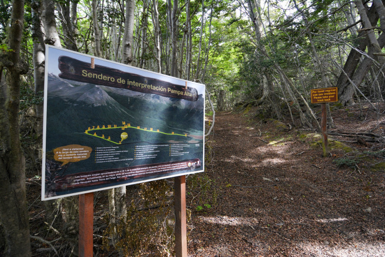
Pampa Alta Trail : this trail begins in the area of Rio Pipo, near the End of the World Train railway. It goes through a dense forest that leads to Pampa Alta, where you can see the Beagle Channel. It can be accessed from the Bahia Ensenada camping site going up the Piloto stream (long option: 4.9 km.) or from National Route 3 (short option 3.7 km.), down the path that joins the road to Río Pipo.
Cerro Guanaco: From the summit of this mountain (970 meters high) there are magnificent panoramic views of the Andes mountain range and the Beagle Channel. Taking the path that leads to Hito XXIV, after a short walk you will find a fork, where a sign on the right marks the beginning of the trail. This is a demanding hike, with a steep climb through the forest and damp muddy areas. The total length is 8 kilometers (round trip) and due to its degree of difficulty, it is mandatory to register at the Visitor's Center and the National Park Office before starting this hike. This trail is only open during the summer season (from November to March). For more information click HERE
In order for you to enjoy your experience in this protected area, we invite you to plan your trip and take the necessary precautions so that your visit does not have a negative impact on the natural environment.
To find information about services, rates, schedules and recommendations for visitors to Tierra del Fuego National Park, click HERE.
Información importante: Nos encontramos actualizando información. Por consultas relacionadas a operadores o prestadores habilitados contactarse al correo serviciosturisticos@infuetur.gob.ar
Puede adquirir esta actividad a través de los siguientes prestadores
Al Sur Turismo
Excursión Parque Nacional Tierra del Fuego
Excursión Lagos
Excursión Lagos y Tolhuin
Excursión Puerto Almanza
City Tour Ushuaia
Traslado Glaciar Martial
Traslado Puerto/Aeropuerto
Traslado Laguna Esmeralda
Albatur SRL
- Excursión Parque Nacional Tierra del Fuego
- City Tour Ushuaia con Glaciar Martial
- Excursión Lagos
Aluen
Recorrido por el Parque Nacional Tierra del Fuego;
Circuito City tour por Ushuaia;
Recorrido por el Lago Escondido y Fagnano
Calaio Viajes y Turismo
- Parque Nacional Tierra del Fuego
- Lagos
Elohim Travel
- Traslados Aeropuerto-hotel
- Excursión Parque Nacional Tierra del Fuego
- City Tour Ushuaia
- Excursión Lagos
Explorando el fin del Mundo
- Avistaje de castores
- City tour Ushuaia
- Estancia Harberton
- Lagos hasta THL
- Parque Nacional Tierra del Fuego
- Puerto Almanza
Explore Tierra del Fuego
Recorrido por el Parque Nacional Tierra del Fuego
Recorrido por el Lago Escondido y Fagnano
Circuito City tour
Recorrido a Puerto Almanza
Recorrido por Estancia Harberton
Fuegian Routes
Excursión Parque Nacional Tierra del Fuego
Excursión Lagos
Excursión City Tour
Excursión Puerto Almanza
Glam Transfers
San Martin 350
Recorridos en Parque Nacional.
Holistic Tour
- Parque Nacional Tierra del Fuego Tradicional
- Parque Nacional Tierra del Fuego con meditación y yoga
- City tour Ushuaia
- Lagos
- Tolhuin
- Laguna Palacios y el Bombilla
- Playa Larga con meditación y yoga
- Puerto Almanza con meditación y yoga
Kami Turismo
Recorrido por el Parque Nacional;
Recorrido por el Lago Escondido y Fagnano
Kren Ushuaia
Excursión Parque Nacional Tierra del Fuego
Traslado Aeropuerto-hotel
Excursión Lagos
Excursión Puerto Almanza
Excursión Tolhuin
Excursión Cabo San Pablo
Lasifashaj Turismo
- Traslado aeropuerto-hotel
- Parque Nacional Tierra del Fuego
- Lagos
- Ruta de la centolla Puerto Almanza
- Centros de montaña
- Traslado Cerro Castor-hotel
LCE Viajes
Recorrido por el Parque Nacional Tierra del Fuego,
Recorrido por los Lagos,
City tour por Ushuaia
Liquen Travel
Excursión Parque Nacional Tierra del Fuego
City Tour Ushuaia + cena
Excursión Puerto Almanza
Excursión Puerto Almanza y Harberton
Excursión Lago Escondido
Traslado Aeropuerto-Hotel
Excursión Cabo San Pablo y visita a Estancias
Mancini Loiacono Alejandro Javier
- Excursión Parque Nacional Tierra del Fuego
- City Tour Ushuaia
- Excursión Tolhuin - Lago Fagnano
Rio Milna
Circuito City tour por Ushuaia
Recorrido por el Parque Nacional
Recorrido a los Lagos Escondido y Fagnano
Traslados al Cerro Castor
Sur Travel Ushuaia
Recorrido por el Parque Nacional Tierra del Fuego (half day y full day)
Recorrido por los Lagos Fueguinos
Recorrido por la Ruta de la Centolla y Puerto Almanza
Recorrido por Cabo San Pablo
City tour por Ushuaia
Taun Ushuaia
- Excursión Parque Nacional Tierra del Fuego
Tekenika
Recorrido por el Parque Nacional Tierra del Fuego;
Circuito City tour por Ushuaia;
Recorrido por el Lago Escondido y Fagnano;
Recorrido por Puerto Almanza y Estancia Harberton
Terrafrost
Excursión Parque Nacional Tierra del Fuego
Excursión Puerto Almanza
Excursión Lagos
Traslado Cerro Castor-hotel
Traslado Puerto Turístico
Excursión City Tour
Excursión Cerro Martial
Traslado Aeropuerto-Hotel
Excursión Paseo de los Presos
Excursión Bahía Encerrada
Excursión Playa Larga
Traslado Centros de montaña
Tommy Adventure
- Excursión Parque Nacional Tierra del Fuego
- Excursión Lagos
Transporte Eliel
Circuito City Tour por Ushuaia
Recorrido por el Parque Nacional
Recorrido por Lago Escondido y Fagnano
Transporte Ona
Bahía Ensenada 580
Recorrido por el Parque Nacional,
Recorrido por los Lagos Escondido y Fagnano,
Traslado a Laguna Esmeralda,
Traslado al Cerro Castor
Ushuaia Elite
Gobernador Godoy 36, 3º 15
Recorrido por el Parque Nacional,
Recorrido al Lago Fagnano
City Tour por Ushuaia
Ushuaia MG Turismo
Recorrido por el Parque Nacional Tierra del Fuego
Recorrido por el Lago Escondido y Centros Invernales
Ushuaia PM
Circuito City tour por Ushuaia;
Recorrid por le Parque Nacional;
Recorrido por los Lagos Escondido y Fagnano;
Recorrido por Puerto Almanza y Punta Paraná.
Vertice Expediciones
Recorrido por los Lagos Escondido y Fagnano,
Recorrido por el Parque Nacional,
Recorrido por Puerto Almanza
Vive Patagonia
Recorrido por el Parque Nacional Tierra del Fuego
Traslado a Cerro Castor
Traslado con espera a Centros Invernales
City tour porTolhuin
Caminata por los Lagos Fagnano y Lago Escondido
Recorrido a Haruwen
Recorrido por Tierra Mayor
Recorrido por Estancia La Carmen
Traslado ocasional a Rio Grande
Traslados a Cabañas Kami y a Hostería Kaiken
También puede realizar esta actividad, contratándola a través de las Agencias de viajes y turismo habilitadas.
Exploring the National Park
Located only a few kilometers from Ushuaia, the Tierra del Fuego National Park is a natural reserve of 63.000 hectares of sub-Antarctic landscape, with deep valleys, dense forests, peat bogs, a coastline, and a magnificent lake located between two mountain ranges. Discover the unforgettable experience of traveling through the unique nature of the End of the World.
When
January
February
March
April
May
June
July
August
September
October
November
December
Tierra del Fuego National Park is located 12 kilometers west of Ushuaia, along National Route 3. Founded in 1960, it is the only national park in Argentina located between the mountains and the sea, since one of its ends borders the southwest coast of the Beagle Channel.
This southern reserve is home to native species such as the red fox and birds such as the caranca, the cauquén marino, the black-browed albatross, the southern steamer duck, the giant woodpecker and the Patagonian thrush , among others. The dense forests are made up of lengas, cherry trees, cinnamon trees and ñires. During autumn, the foliage of these trees creates an unforgettable postcard of red, gold and green colors.
Its peculiar geography, which combines the maritime environment with the Andean mountain range, displays a captivating scenery. The serene beauty of Lake Acigami/Roca, called Acigami by the natives of the island, invites you to sit on its shore and enjoy the sound of the waves. Next to the lake, there is a camping area, and on the right bank, there is a path that leads to the Milestone 24 , which marks the territorial boundary with Chile. Another scenic spot is Lapataia Bay , where you will find the sign that marks the end of National Route 3.
The activities allowed in this reserve are hiking, guided canoeing and fishing. For trekking lovers, the park is an ideal option, since it has a network of signposted trails of about 40 kilometers that vary in length and degree of difficulty. Below, you can check the listing of trails open to the public.
Low Difficulty Hikes
Paseo de la Isla : this trail runs along the shores of the Lapataia and Ovando rivers, from where you can see the Cormorant Archipelago. Approximate length: 800 meters.
Mirador Trail : Crossing the Park through the forest of lengas and coihues, it skirts the bottom of Lapataia Bay until reaching the Beagle Channel. The panoramic view is splendid.
Castorera Trail: It is reached by Route Nº 3 going up the course of Los Castores creek on its right bank. In this area you can observe the impact that beavers have caused in the environment.
Turbal Trail: This is an easy 400 meters path that leads to Lapataia Bay. On the way through the lenga and coihue forest, you can see an abandoned beaver dam.
Laguna Negra Trail : Another low difficulty path that leads to a lagoon located south of Lake Roca. Its name (black lagoon) comes from the dark coloration of its waters due to the effect of the peat.
Baliza Trail : In Lapataia Bay there is a fork to this trail. After a short walk along the forest, you will see a beaver dam. Following the path, you will get to the coastline of the Beagle Channel, where a beacon marks the end of the trail.
Medium Difficulty Hikes
Coastal Path: It begins at Ensenada Bay, bordering the coast of the Beagle Channel and ends at the crossing of Route 3, near Lake Roca. The trail is 8 kilometers long. For more information click HERE
Hito XXIV Trail: this trail borders the northern shore of Lake Roca and leads to the international border with Chile. The trail goes through dense lenga forests and from the shore of the lake you can enjoy magnificent views of the surrounding mountains.
High Difficulty Hikes
Pampa Alta Trail : this trail begins in the area of Rio Pipo, near the End of the World Train railway. It goes through a dense forest that leads to Pampa Alta, where you can see the Beagle Channel. It can be accessed from the Bahia Ensenada camping site going up the Piloto stream (long option: 4.9 km.) or from National Route 3 (short option 3.7 km.), down the path that joins the road to Río Pipo.
Cerro Guanaco: From the summit of this mountain (970 meters high) there are magnificent panoramic views of the Andes mountain range and the Beagle Channel. Taking the path that leads to Hito XXIV, after a short walk you will find a fork, where a sign on the right marks the beginning of the trail. This is a demanding hike, with a steep climb through the forest and damp muddy areas. The total length is 8 kilometers (round trip) and due to its degree of difficulty, it is mandatory to register at the Visitor's Center and the National Park Office before starting this hike. This trail is only open during the summer season (from November to March). For more information click HERE
In order for you to enjoy your experience in this protected area, we invite you to plan your trip and take the necessary precautions so that your visit does not have a negative impact on the natural environment.
To find information about services, rates, schedules and recommendations for visitors to Tierra del Fuego National Park, click HERE.