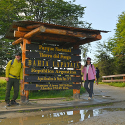
Cerro Guanaco trail-National Park
This hike takes you through the forests of the Tierra del Fuego National Park to the top of Cerro Guanaco, almost 1,000 meters above sea level. The panoramic view is unforgettable.
report_problem
IMPORTANT: During autumn/winter season it is necessary to take precautions due to the decrease in daylight hours, below zero temperatures, and icy or snowy conditions on the trails. It's essential to have the proper gear and footwear. In case of emergency call 103.
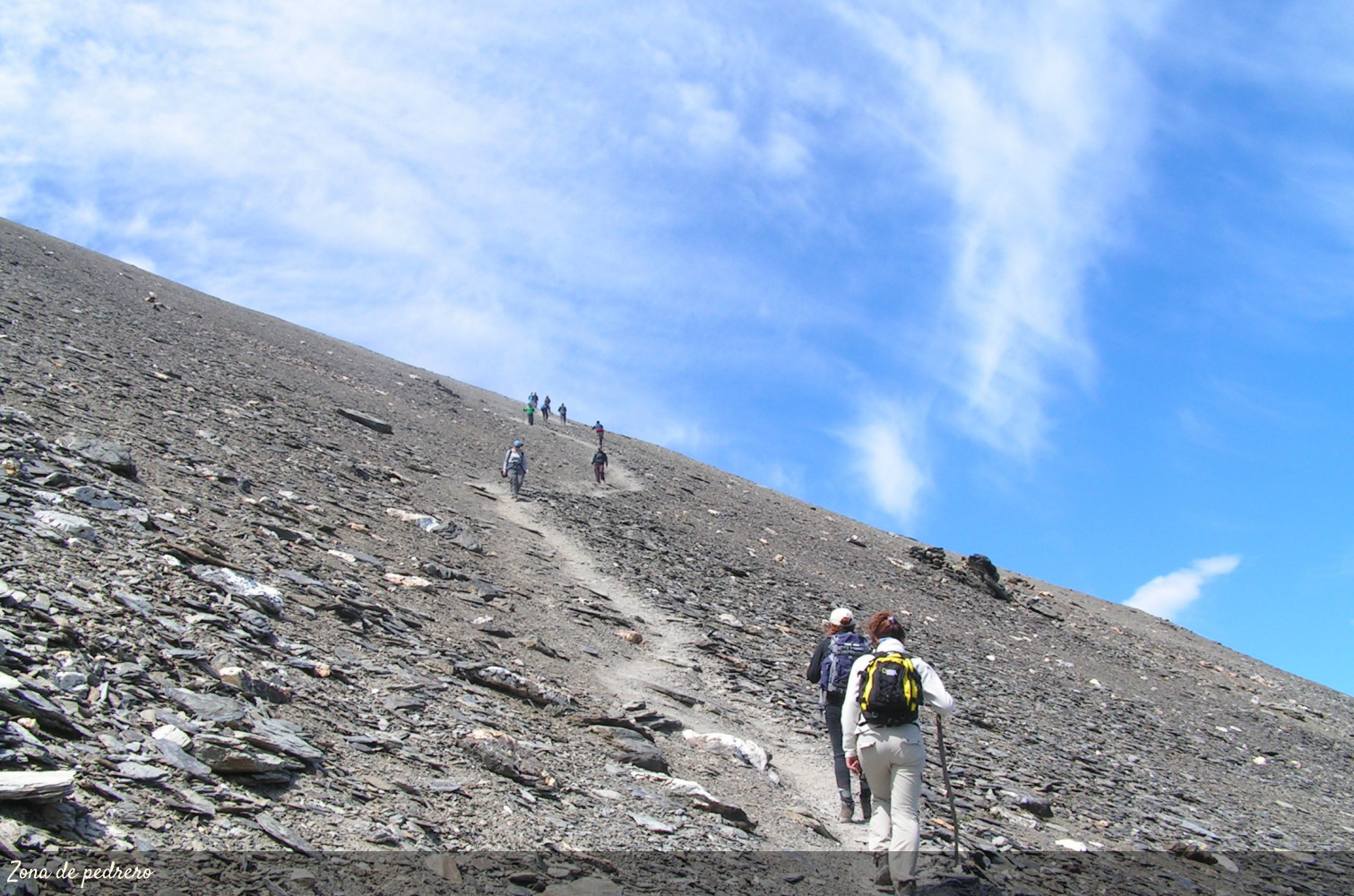
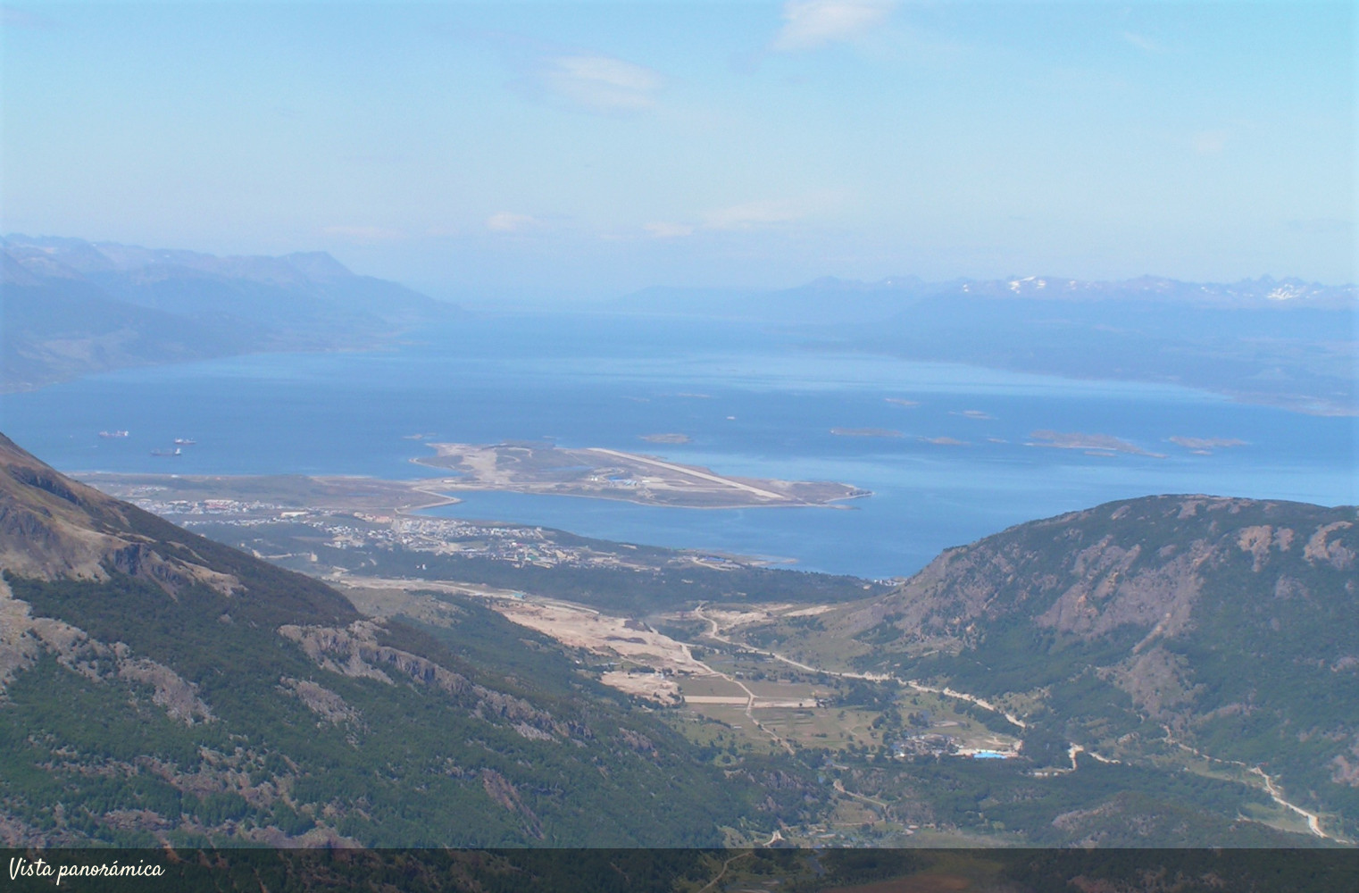
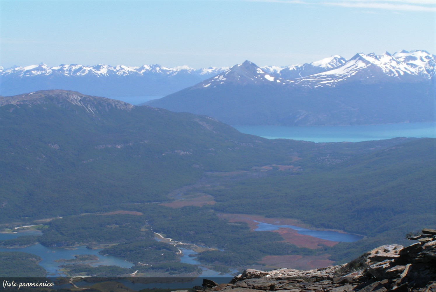
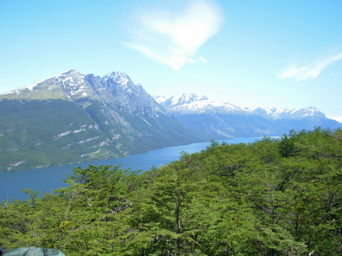
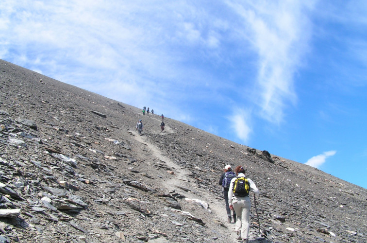
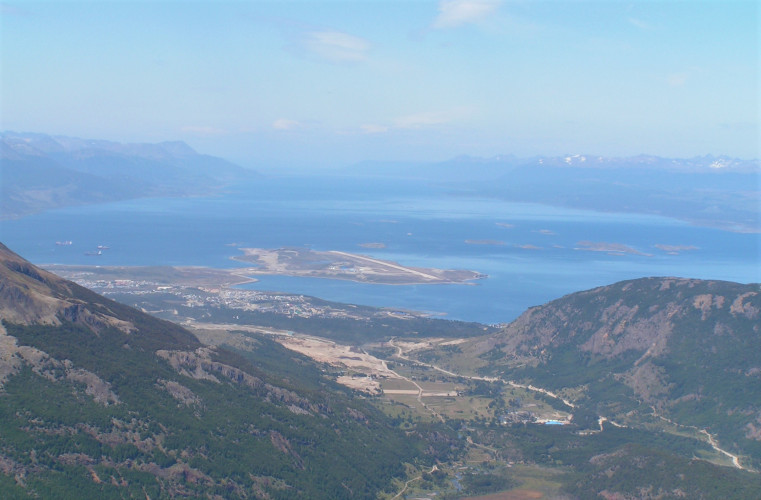
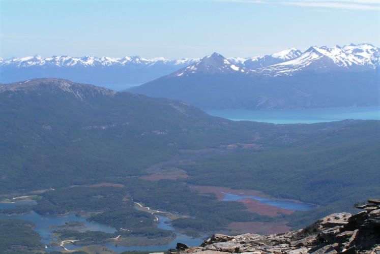
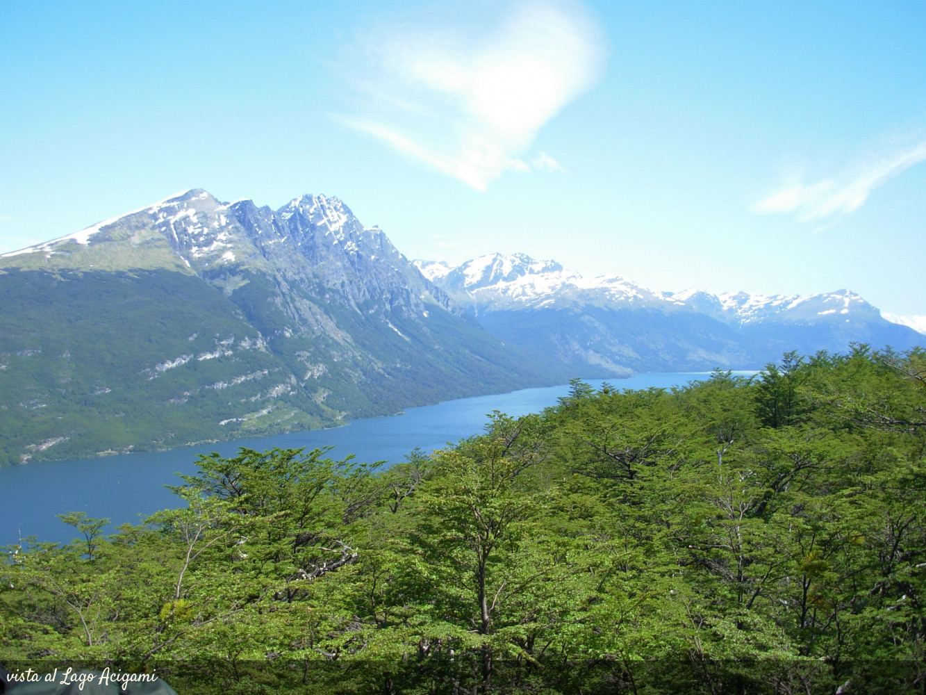
This trail is demanding, since in its final stretch you must climb the mountainside, which has an altitude of 960 meters above sea level. To get to the beginning of the trail, first you must take the path that starts on the right bank of Lake Acigami, until you reach a fork with a sign that marks the Hito XXIV and Cerro Guanaco trail. From there the trail enters a dense forest and ascends through humid and steep terrain until it reaches the slopes of the Cerro. This part of the trekking is the most demanding, but once at the top, you get a magnificent panoramic view of the Beagle Channel, the surrounding mountains and the National Park.
Although the estimated duration of this hike is 4 hours (one way), it may take longer depending on the physical condition of each person and the conditions of the trail. Therefore, it is crucial to leave early enough, and prepare for the ascent to the hill with appropriate footwear, clothing and supplies.
Open