La reserva es atravesada en forma longitudinal por la Ruta Nacional 3, por lo tanto recorriendo esta ruta al norte desde Ushuaia (20 Km de la ciudad) y al sur desde Río Grande (180 Km aproximadamente desde la ciudad).
¿Are you in Tierra del Fuego? Check how to get here from your location
directions_walk directions_carLocation: The reserve covers the watersheds of the Olivia and Lasifashaj Rivers to the confluence of this with the hungry river included in the Tierra del Fuego National Park, in the Ushuaia department of the Tierra del Fuego province, 20 km from the city capital.
Conservation value:
The main characteristic of the reserve is its scenic and scenic beauty, its objectives are the preservation of species and the maintenance of genetic diversity, the conservation of biological diversity and the landscape. The use is exclusively tourist.
What services does it offer?
The reserve is prepared for the visit of residents and foreign tourists who come to enjoy the diversity of recreational and sports activities, as well as the gastronomic offer and accommodation in a natural environment.
At present, there are ten providers of services and activities located in the Tierra Mayor Valley. The benefits vary according to the time of year, developing during the winter season, the strongest activity in the Valley. The so-called winter centers that are part of the area of the Management Plan are the following:
- Cerro Castor
- Valle de Lobos
- Ushuaia Blanca
- Las Cotorras
- Siberianos de Fuego
- Nunatak
- Haruwen
- Tierra Mayor
- Valle Hermoso
- Llanos del Castor
These providers offer a wide variety of activities and services in the Valley, including:
- Sightseeing and ecotourism
- Andean skiing
- Cross country ski
- Cross-country ski
- Snowshoeing
- 4x4 rides
- Rides on quads
- Snowmobile rides
- Dog sled rides
- Ice skate
- Snowboard
- Trekking
- Accommodation
- Restoration
Description:
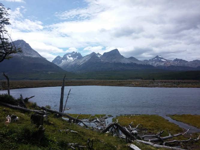
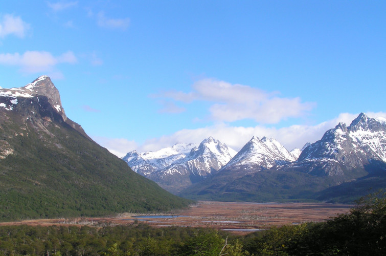
The Tierra Mayor Valley is a wide valley of glacial origin, traversed by the Lasifashaj River that forms a great number of meanders, which flows into the vicinity of Estancia Harberton. The beginning of the valley coincides with the point where the Carbajal valley turns to the south, then runs straight between mountains, within the Fuegian Andes range from west to east. The dividing lines of waters mark its northern and southern limits. In the north, the Alvear mountain range separates it from Lake Fagnano, and to the south another line of mountains, the Sierra de Sorondo, separate it from the Beagle channel. The valley is largely occupied by Sphagnum bogs. The slopes of the mountains are covered by the characteristic Fuegian forest, where the trees of the genus Nothofagus dominate. Above the forest boundary, we find a high Andean ecosystem, with some peat bogs.
Part of the valley is framed, next to part of the Carbajal valley, within the Valle Tierra Mayor Natural Reserve. The reserve was conceived as a tourist corridor so its location is determined along the National Route No. 3. It has an extension from west to east from the eastern boundary of the Tierra del Fuego National Park to the confluence of the Lasifashaj and Hungry, with an approximate area of 370 km2, and a length of about 40 km and an average width of approximately 8 km.
Creation story:
The use of the Tierra Mayor Valley for sports activities had its origins with the beginning of the Cross-country Skiing, activity that began to develop in Tierra del Fuego in 1975. Francisco Jerman, from Bariloche, instructor of Cross-country skiing, up to the Ex Territory of Tierra del Fuego at the request of the Andean Club to dictate a course of this sport and it was he, who considered that one of the most suitable sectors for its realization was the Tierra Mayor valley.
Valle Tierra Mayor Natural and Landscape Reserve was created in 1994 by Provincial Decree Nº 2256/1994, with the objective of preserving the natural environment and scenic beauty; and for an exclusively tourist use. In the year 2003 the Provincial Legislature sanctioned the Provincial Law N ° 597, of Territorial Organization of the South-West Sector of the Argentine territory of the Big Island of Tierra del Fuego, as Development Program with the Zoning, Conditions and Restrictions of
Use of said geographical area.
The western half of the zone defined and delimited by articles 5 and 6 of Provincial Law N ° 597, such as Valle de los Ríos Olivia and Lasifashaj, contains the Natural and Landscape Reserve that was instituted by Provincial Decree N ° 2256/1994. Its jurisdiction and type of administration are provincial, with INFUETUR being the agency in charge of organizing and implementing the supervision, inspection and authorization of all the tourist services in that area. The domain of the land and its resources and natural environments is Provincial Prosecutor.